Ports to Plains Alliance
Welcome to Ports-to-Plains Alliance, a non-profit, bipartisan, grassroots alliance of more than 200 partner communities and businesses across nine states. We advocate for a robust international transportation infrastructure to promote economic security and prosperity throughout North America’s energy and agricultural heartland including Mexico to Canada.
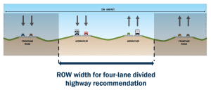
It is critical that the infrastructure is upgraded and modernized to meet the needs of trade and economic activity. The Alliance currently advocated for a four-lane divided highway or interstate highway connecting our communities to domestic and international markets across North America.

Billions secured in state and federal funding for projects throughout the nine-state Corridor

Secured support and studies for a future interstate in Texas, New Mexico, Oklahoma and Colorado

Developed crucial relationships with national and state legislatures and state departments of transportation

Maintains a 200 member partnership including the Heartland Expressway Association and Theodore Roosevelt Expressway Association
Latest News
News and Fact Sheets for Future Interstate

For the latest news on the Future Interstate and access to the the Activities and Fact Sheets of the I-27 Advisory Committee, click below.
2023 Ports-to-Plains Alliance Conference September 13-15, 2023
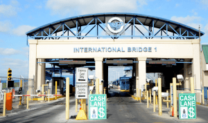
Eagle Pass, Texas
FY24 Mini-Appropriations Bill Brings $29.165 Million
to Ports-to-Plains Alliance Projects
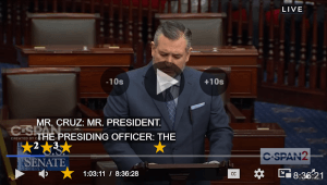
I-27 Numbering Act of 2023 (S.992) Passes Final Action in U.S. Senate Allocating
an Official Name to the Ports-to-Plains Corridor

US Designates Future Interstate 27 Part of the Interstate Highway System

March 2024 Vol 22 Issue 3 Newsletter
Ports-to-Plains Newslane March 2024 | President’s Corner | I-27 Numbering Act Finalized | FY24 Mini-Appropriations Bill Brings $29.165 Million to Ports-to-Plains Alliance Projects | Crossing borders, connecting economies:|
