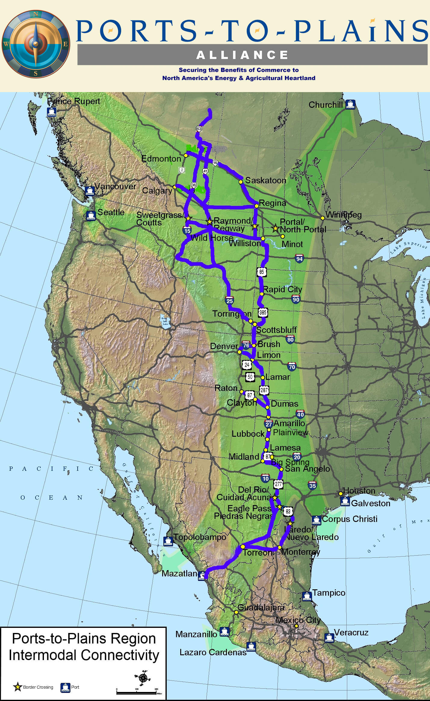
Information on Future Interstate Highway
  • Home
    • Search Our Site
    • Site Map
  • Our Alliance
    • Our Board
    • Our Staff
    • Ports-to-Plains History
    • Membership Information
    • Static Maps
  • Partners
    • Heartland Expressway Association
    • Theodore Roosevelt Expressway Association
  • Advocacy
    • Energy
    • Transportation
    • Policy
    • Future Interstate Highway
    • Research
  • News/Events
    • Newsletters
    • News Releases
    • Calendar
  • Avoiding Freight Bottlenecks
  • Intermodal Connections
  • Layered Base Map
  • Travel Time Comparison
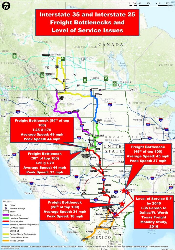
This map shows Freight Bottleneck and Level of Service Issues with Interstate 35 and Interstate 25.

To download CLICK HERE or on the image to save or print this map as a pdf. For image RIGHT CLICK image and "Save As".

To download CLICK HERE or on the image to save or print this map. For image RIGHT CLICK image and "Save As".


To download CLICK HERE or on the image to save or print this map as a pdf. For image RIGHT CLICK image and "Save As".


This map shows comparitive travel times from Laredo, TX to St. Louis, MO by Interstate 35 or
Ports-to-Plains/Interstate 27.


To download CLICK HERE or on the image to save or print this map as a pdf. For image RIGHT CLICK image and "Save As".

map travel time Comparison I35 expanded I27

  • Terms of Use
  • Privacy Statement
  • Contact PtP
  • Search
  • NVPS
  • mt
Alliance Logo HiRes2
Back to top